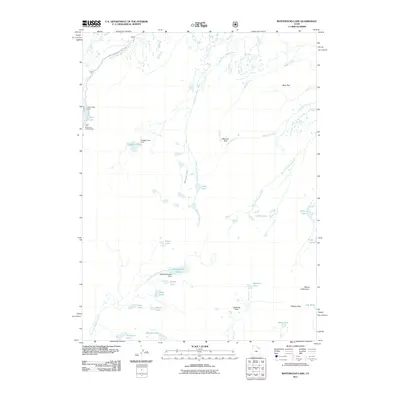
2011 Map of Whiterocks Lake
USGS Topo · Published 2011About this map
Spirit Lake Campground serves as a key recreational anchor in this high-altitude landscape, where managed water resources define the topography. The area's hydrology is characterized by several engineering features, including Spirit Lake Dam, Daggett Lake Dam, and Whiterocks Lake Dam, which regulate the flow of the East Fork Whiterocks River and surrounding glacial basins. The terrain transitions from these water bodies to prominent high-country features such as Mount Untermann and Gabbro Pass in the southeast.
Find a feature on this map
35 named features on this map. Tap any name to fly to it.
Don’t see what you’re looking for? This feature index may not catch every label — zoom into the map to look around manually.
Map Details
Editions of this 2011 Whiterocks Lake Map
This is the sole edition of this map. No revisions or reprints were ever made.
Other maps of this area

1885 · Ashley
USGS Topo · 1:250,000

1885 · Uinta
USGS Topo · 1:250,000

1905 · Gilbert Peak
USGS Topo · 1:125,000

1906 · Gilbert Peak
USGS Topo · 1:125,000

1906 · Marsh Peak
USGS Topo · 1:125,000

1908 · Marsh Peak
USGS Topo · 1:125,000

1954 · Salt Lake City
USGS Topo · 1:250,000

1954 · Vernal
USGS Topo · 1:250,000

1958 · Vernal
USGS Topo · 1:250,000

1958 · Salt Lake City
USGS Topo · 1:250,000