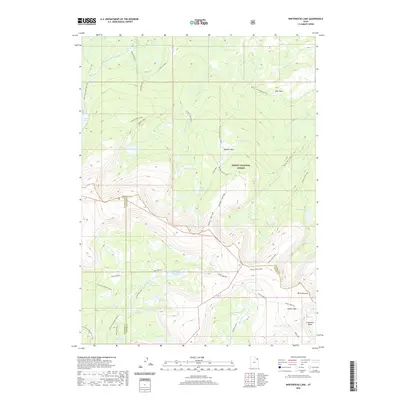
2020 Map of Whiterocks Lake
USGS Topo · Published 2020About this map
Ashley National Forest dominates this high-altitude landscape in the Uinta Mountains, where the boundaries of Daggett, Duchesne, and Uintah counties converge. The hydrology of the region is defined by glacial catchments, including the headwaters of the East Fork Whiterocks River and several distinct lake clusters such as the Weyman Lakes and Potter-Lamb Lakes. High-country navigation is centered on the Uinta Highline, a significant trail that traverses the southern half of the map, passing beneath landmarks like Mt Untermann and through the Gabbro Pass.
Find a feature on this map
42 named features on this map. Tap any name to fly to it.
Don’t see what you’re looking for? This feature index may not catch every label — zoom into the map to look around manually.
Map Details
Editions of this 2020 Whiterocks Lake Map
This is the sole edition of this map. No revisions or reprints were ever made.
Other maps of this area

1885 · Ashley
USGS Topo · 1:250,000

1885 · Uinta
USGS Topo · 1:250,000

1905 · Gilbert Peak
USGS Topo · 1:125,000

1906 · Gilbert Peak
USGS Topo · 1:125,000

1906 · Marsh Peak
USGS Topo · 1:125,000

1908 · Marsh Peak
USGS Topo · 1:125,000

1954 · Salt Lake City
USGS Topo · 1:250,000

1954 · Vernal
USGS Topo · 1:250,000

1958 · Vernal
USGS Topo · 1:250,000

1958 · Salt Lake City
USGS Topo · 1:250,000