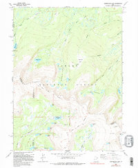
1990 Map of Whiterocks Lake
USGS Topo · Published 1995About this map
The Old Indian Treaty Boundary slices through the high country of the Ashley National Forest, marking a historic line across a landscape defined by glacial basins and alpine water systems. This high-elevation terrain is characterized by a dense concentration of mountain lakes, from the large Whiterocks Lake and Spirit Lake to the clustered Weyman Lakes and Lamb Lakes. The hydrology is complex, with the Middle Fork Sheep Creek and South Fork Sheep Creek carving paths through the northern slopes while the Whiterocks Fork drains the south.
Find a feature on this map
36 named features on this map. Tap any name to fly to it.
Don’t see what you’re looking for? This feature index may not catch every label — zoom into the map to look around manually.
Map Details
Editions of this 1990 Whiterocks Lake Map
This is the sole edition of this map. No revisions or reprints were ever made.
Other maps of this area

1885 · Ashley
USGS Topo · 1:250,000

1885 · Uinta
USGS Topo · 1:250,000

1905 · Gilbert Peak
USGS Topo · 1:125,000

1906 · Gilbert Peak
USGS Topo · 1:125,000

1906 · Marsh Peak
USGS Topo · 1:125,000

1908 · Marsh Peak
USGS Topo · 1:125,000

1954 · Salt Lake City
USGS Topo · 1:250,000

1954 · Vernal
USGS Topo · 1:250,000

1958 · Vernal
USGS Topo · 1:250,000

1958 · Salt Lake City
USGS Topo · 1:250,000