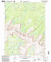
1996 Map of Whiterocks Lake
USGS Topo · Published 1999About this map
High-altitude basin terrain within the Ashley National Forest dominates this 1990s revision, capturing a complex alpine landscape defined by glacial lakes and sharp ridgelines. The map centers on the high wilderness where the boundaries of Daggett, Duchesne, and Uintah counties converge. Noteworthy landmarks such as Chepeta and Mount Untermann provide vertical context for the numerous water bodies, including the prominent Whiterocks Lake, Spirit Lake, and the clustered Weyman Lakes.
Find a feature on this map
37 named features on this map. Tap any name to fly to it.
Don’t see what you’re looking for? This feature index may not catch every label — zoom into the map to look around manually.
Map Details
Editions of this 1996 Whiterocks Lake Map
This is the sole edition of this map. No revisions or reprints were ever made.
Other maps of this area

1885 · Ashley
USGS Topo · 1:250,000

1885 · Uinta
USGS Topo · 1:250,000

1905 · Gilbert Peak
USGS Topo · 1:125,000

1906 · Gilbert Peak
USGS Topo · 1:125,000

1906 · Marsh Peak
USGS Topo · 1:125,000

1908 · Marsh Peak
USGS Topo · 1:125,000

1954 · Salt Lake City
USGS Topo · 1:250,000

1954 · Vernal
USGS Topo · 1:250,000

1958 · Vernal
USGS Topo · 1:250,000

1958 · Salt Lake City
USGS Topo · 1:250,000