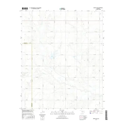
2016 Map of Whites Lake
USGS Topo · Published 2016About this map
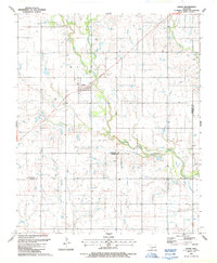
The boundary between Cotton County and Tillman County runs through this landscape of meandering watercourses in southwestern Oklahoma. Deep Red Creek dominates the southern half of the quadrangle, joined by the smaller Dry Red Creek and Sanatag Creek. These natural drainages define the rolling prairie, which by this era is heavily partitioned by a precise grid of rural roads such as Co RD e1850 and Co RD n2480. Whites Lake and the 033006 Reservoir serve as prominent local landmarks amidst the agricultural plots. This survey illustrates the modern intersection of natural hydrology and the section-line road system that has organized the Oklahoma plains for over a century.
Find a feature on this map
25 named features on this map. Tap any name to fly to it.
Don’t see what you’re looking for? This feature index may not catch every label — zoom into the map to look around manually.
Map Details
Editions of this 2016 Whites Lake Map
This is the sole edition of this map. No revisions or reprints were ever made.
Other maps of this area

1955 · Lawton
USGS Topo · 1:250,000

1957 · Burkburnett
USGS Topo · 1:62,500

1957 · Randlett
USGS Topo · 1:62,500

1962 · Chattanooga
USGS Topo · 1:62,500

1962 · Walters
USGS Topo · 1:62,500
1985 · Randlett
USGS Topo · 1:24,000
1985 · Grandfield
USGS Topo · 1:24,000
1985 · Devol
USGS Topo · 1:24,000

1985 · Burkburnett
USGS Topo · 1:100,000
1987 · Faxon
USGS Topo · 1:24,000