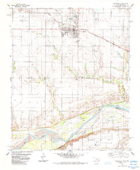
1985 Map of Grandfield
USGS Topo · Published 1985About this map
The Grandfield townsite and surrounding Tillman County landscape appear here just before the mid-1980s, revealing a region defined by its proximity to the Texas border and its varied industrial interests. The Missouri Kansas Texas railroad cuts a diagonal path through the settlement, connecting the town to the wider grain and freight networks of the Southern Plains. To the south, the Red River marks the state boundary, its shifting channel creating features like Burke Island and providing a natural terminus for the numerous Oil Wells that dot the southern sections.
Find a feature on this map
22 named features on this map. Tap any name to fly to it.
Don’t see what you’re looking for? This feature index may not catch every label — zoom into the map to look around manually.
Map Details
Editions of this 1985 Grandfield Map
This is the sole edition of this map. No revisions or reprints were ever made.
Other maps of this area

1915 · Clara
USGS Topo · 1:24,000

1915 · Barwise School
USGS Topo · 1:24,000

1915 · Burkburnett
USGS Topo · 1:24,000

1918 · Buckburnett
USGS Topo · 1:31,680

1918 · Barwise School
USGS Topo · 1:31,680

1918 · Clara
USGS Topo · 1:31,680

1955 · Lawton
USGS Topo · 1:250,000

1957 · Burkburnett
USGS Topo · 1:62,500

1958 · Electra
USGS Topo · 1:62,500

1962 · Chattanooga
USGS Topo · 1:62,500