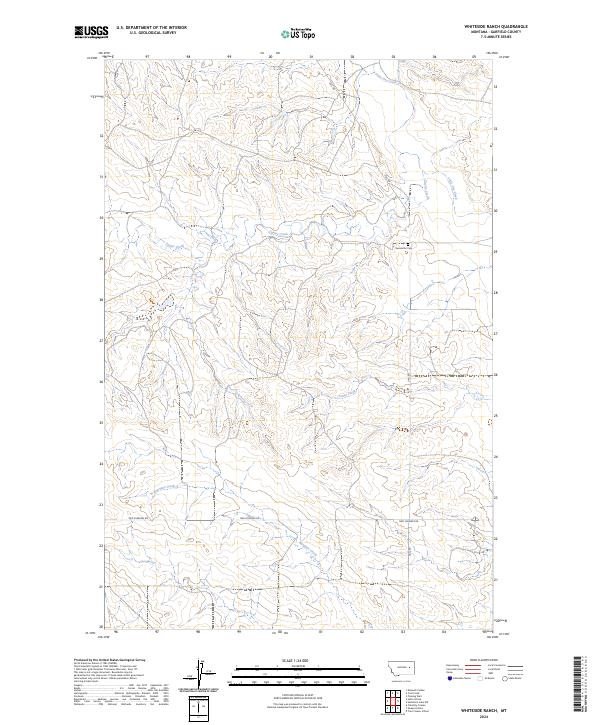
2024 Map of Whiteside Ranch
USGS Topo · Published 2024About this map
Little Dry Creek and its southern tributaries define the topography of this Garfield County landscape, where the drainage systems of Taylor Creek, Jones Creek, and Antelope Creek have carved a complex network of coulees across the high plains. The map reflects a deeply rural and sparse ranching territory, structured by the Public Land Survey System through townships such as t17n r43e and t16n r42e. Human presence is concentrated along primitive and unpaved routes like Uall Rd and Two Furrows Rd. A primary point of genealogical interest is the Neudorfer Cem located north of Taylor Creek, marking a quiet historical site amidst the open range.
Find a feature on this map
11 named features on this map. Tap any name to fly to it.
Don’t see what you’re looking for? This feature index may not catch every label — zoom into the map to look around manually.
Map Details
Editions of this 2024 Whiteside Ranch Map
This is the sole edition of this map. No revisions or reprints were ever made.
Other maps of this area

1954 · Jordan
USGS Topo · 1:250,000

1956 · Jordan
USGS Topo · 1:250,000

1958 · Jordan
USGS Topo · 1:250,000

1964 · Jordan
USGS Topo · 1:250,000

1965 · Whiteside Ranch
USGS Topo · 1:24,000

1965 · Calamity Coulee
USGS Topo · 1:24,000
1965 · Tree Coulee School
USGS Topo · 1:24,000

1965 · Hedstrom Lake NW
USGS Topo · 1:24,000

1965 · Hafla School
USGS Topo · 1:24,000
1965 · Sleepy Hollow
USGS Topo · 1:24,000