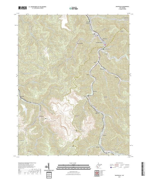
2023 Map of Whitesville
USGS Topo · Published 2023About this map
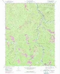
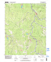
The Marsh Fork river valley serves as the primary corridor for settlement and industry through the coalfields of Boone Co and Raleigh Co. This landscape is defined by its narrow hollows and high ridges, where the CSX railroad tracks follow the winding watercourses to serve coal-rich communities like Montcoal, Birchton, and Edwight. High above the valley floor, landmarks like Kayford Mountain and Cherry Pond Mountain overlook a network of winding mountain roads and industrial clearings.
Find a feature on this map
70 named features on this map. Tap any name to fly to it.
Don’t see what you’re looking for? This feature index may not catch every label — zoom into the map to look around manually.
Map Details
Editions of this 2023 Whitesville Map
This is the sole edition of this map. No revisions or reprints were ever made.
Historical Maps of Janie Through Time
3 maps found