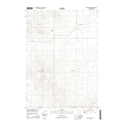
2015 Map of Whitetail Creek
USGS Topo · Published 2015About this map
The Belle Fourche River winds through this section of Campbell County, serving as the primary drainage for a landscape defined by sharp topographic shifts and high plains drainage systems. In the northwestern portion of the map, Cabin Canyon Reservoir sits within the eponymous Cabin Canyon, collecting seasonal runoff before it joins the larger river network. The terrain is marked by significant landmarks like the Yellow Hammer Buttes in the southwest, which rise above the surrounding drainages of Yellow Hammer Cr and Little Piney Cr. Transportation through this isolated rangeland is primarily facilitated by Bishop Rd, which cuts across the central and northern sections. The map also captures the path of Whitetail Cr as it flows southeast, illustrating the complex hydrology that supports this high-desert environment.
Find a feature on this map
14 named features on this map. Tap any name to fly to it.
Don’t see what you’re looking for? This feature index may not catch every label — zoom into the map to look around manually.
Map Details
Editions of this 2015 Whitetail Creek Map
This is the sole edition of this map. No revisions or reprints were ever made.
Other maps of this area

1954 · Gillette
USGS Topo · 1:250,000

1955 · Newcastle
USGS Topo · 1:250,000

1955 · Gillette
USGS Topo · 1:250,000

1958 · Gillette
USGS Topo · 1:250,000

1958 · Newcastle
USGS Topo · 1:250,000

1962 · Gillette
USGS Topo · 1:250,000

1971 · Coyote Draw
USGS Topo · 1:24,000

1971 · Coon Track Creek
USGS Topo · 1:24,000

1971 · Whitetail Creek
USGS Topo · 1:24,000

1971 · Rough Creek
USGS Topo · 1:24,000