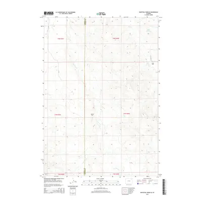
2015 Map of Whitetail Creek SE
USGS Topo · Published 2015About this map
The Campbell and Weston county line bisects this high plains landscape, documenting a region defined by its drainage systems and ranching roads in the mid-2010s. Water management is a primary feature of the local geography, anchored by the Baker Number 2 Reservoir in the northeast and the seasonal flow of Raven Cr. The terrain is characterized by numerous erosional features, including Mexican Draw and Cedar Draw, which channel runoff toward Four Horse Cr. Transport is restricted to functional routes such as Four Horse Rd and Or Rd, reflecting the sparse settlement patterns typical of this portion of Wyoming. The map provides a precise look at the Public Land Survey System grid, including boundaries for t47n r68w and surrounding townships, which remains the fundamental framework for land ownership and resource management in the area.
Find a feature on this map
14 named features on this map. Tap any name to fly to it.
Don’t see what you’re looking for? This feature index may not catch every label — zoom into the map to look around manually.
Map Details
Editions of this 2015 Whitetail Creek SE Map
This is the sole edition of this map. No revisions or reprints were ever made.
Other maps of this area

1918 · Moorcroft
USGS Topo · 1:125,000

1954 · Gillette
USGS Topo · 1:250,000

1955 · Newcastle
USGS Topo · 1:250,000

1955 · Gillette
USGS Topo · 1:250,000

1958 · Gillette
USGS Topo · 1:250,000

1958 · Newcastle
USGS Topo · 1:250,000

1962 · Gillette
USGS Topo · 1:250,000

1971 · Coon Track Creek
USGS Topo · 1:24,000

1971 · Whitetail Creek
USGS Topo · 1:24,000

1971 · Rough Creek
USGS Topo · 1:24,000