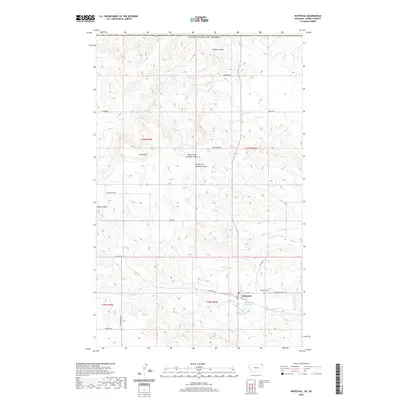
2020 Map of Whitetail
USGS Topo · Published 2020About this map
Whitetail sits near the northern edge of Daniels County, Montana, just south of the border with the United States of America. This landscape is defined by the high plains drainages of Whitetail Creek and its associated Whitetail Reservoir. The topography transitions from the flatlands of the southern townships to more prominent landforms in the north, including Square Butte and Long Butte. A network of section roads like W Whitetail Rd and N Rangeline Rd reveals the persistent grid of the Public Land Survey System. Further north, the terrain becomes more broken, carved by North Fork Goodale Coulee, South Fork Goodale Coulee, and the suggestively named Outlaw Coulee. For those tracing local history, the Whitetail Cem stands as a focal point for the surrounding rural community.
Find a feature on this map
27 named features on this map. Tap any name to fly to it.
Don’t see what you’re looking for? This feature index may not catch every label — zoom into the map to look around manually.
Map Details
Editions of this 2020 Whitetail Map
This is the sole edition of this map. No revisions or reprints were ever made.
Other maps of this area

1954 · Wolf Point
USGS Topo · 1:250,000

1958 · Wolf Point
USGS Topo · 1:250,000

1973 · Madoc
USGS Topo · 1:24,000

1973 · Flaxville
USGS Topo · 1:24,000

1973 · Whitetail
USGS Topo · 1:24,000

1973 · Navajo
USGS Topo · 1:24,000

1973 · Goodale Coulee
USGS Topo · 1:24,000

1973 · Si Merrell Slough
USGS Topo · 1:24,000

1983 · Scobey
USGS Topo · 1:100,000
2011 · Si Merrell Slough
USGS Topo · 1:24,000