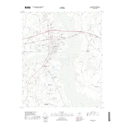
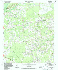
2019 Map of Whiteville
USGS Topo · Published 2019About this map
Whiteville serves as the central hub of this Columbus County landscape, where the urban grid meets the extensive lowlands of the Coastal Plain. The drainage patterns of Soules Swamp and White Marsh dictate the regional development, as seen in the clustered communities of South Whiteville and Brunswick. To the south, Richardson Millpond and several drainage branches like Camp Br and Mill Br suggest a history of water management and local industry integrated into the marshy terrain. The map is particularly useful for genealogical research, documenting several dispersed family and community burial grounds including Whiteville Cem, Flynn Cem, and Faison Cem. Rural outposts such as Harrelsonville Crossroads and Honey Hill show how settlement has moved along the primary corridors leading away from the county seat toward the surrounding swamps and timberlands.
Find a feature on this map
153 named features on this map. Tap any name to fly to it.
Don’t see what you’re looking for? This feature index may not catch every label — zoom into the map to look around manually.
Map Details
Editions of this 2019 Whiteville Map
This is the sole edition of this map. No revisions or reprints were ever made.
Other maps of this area

1943 · Nakina
USGS Topo · 1:24,000

1953 · Chadbourn
USGS Topo · 1:62,500

1953 · Florence
USGS Topo · 1:250,000

1954 · Florence
USGS Topo · 1:250,000

1955 · Whiteville
USGS Topo · 1:62,500
1962 · Tabor City East
USGS Topo · 1:24,000
1962 · Tabor City
USGS Topo · 1:62,500

1986 · Whiteville
USGS Topo · 1:100,000
1986 · Chadbourn
USGS Topo · 1:24,000
1986 · Chadbourn NE
USGS Topo · 1:24,000