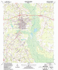
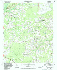
1987 Map of Whiteville
USGS Topo · Published 1987About this map
Whiteville serves as the focal point of this late-1980s landscape, where the urban grid meets the extensive wetlands of the Carolina coastal plain. The town's significance as a regional hub is reflected in the concentration of civic institutions, including the Courthouse, County Hospital, and several educational centers like the Columbia Christian Academy. The surrounding terrain is defined by the broad expanse of White Marsh and Soules Swamp, which frame the community to the east and south.
Find a feature on this map
72 named features on this map. Tap any name to fly to it.
Don’t see what you’re looking for? This feature index may not catch every label — zoom into the map to look around manually.
Map Details
Editions of this 1987 Whiteville Map
This is the sole edition of this map. No revisions or reprints were ever made.
Other maps of this area

1943 · Nakina
USGS Topo · 1:24,000

1953 · Chadbourn
USGS Topo · 1:62,500

1953 · Florence
USGS Topo · 1:250,000

1954 · Florence
USGS Topo · 1:250,000

1955 · Whiteville
USGS Topo · 1:62,500
1962 · Tabor City East
USGS Topo · 1:24,000
1962 · Tabor City
USGS Topo · 1:62,500

1986 · Whiteville
USGS Topo · 1:100,000
1986 · Chadbourn
USGS Topo · 1:24,000
1986 · Chadbourn NE
USGS Topo · 1:24,000