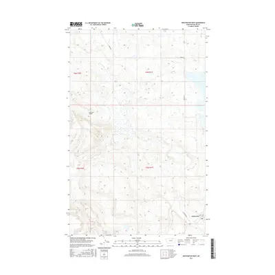
2017 Map of Whitewater West
USGS Topo · Published 2017About this map
Whitewater serves as the primary settlement hub in this part of Phillips County, situated near the intersection of Whitewater Rd and Main St. This survey reflects a landscape defined by expansive township boundaries such as t36n r31e and t35n r31e, where the terrain is marked by seasonal drainages and isolated water sources. Significant natural landmarks include the Lone Tree Coulee to the northwest and the drainage of Dibble Cr, which is fed by Dibble Spring. The map identifies the local Po (Post Office) within the town site, anchoring the community amidst the surrounding agricultural and open lands. Toward the northern edge of the quadrangle, Border Rd traverses the high plains, illustrating the grid-based transportation network typical of this rural Montana region.
Find a feature on this map
12 named features on this map. Tap any name to fly to it.
Don’t see what you’re looking for? This feature index may not catch every label — zoom into the map to look around manually.
Map Details
Editions of this 2017 Whitewater West Map
This is the sole edition of this map. No revisions or reprints were ever made.
Other maps of this area

1920 · Cowan
USGS Topo · 1:125,000

1954 · Glasgow
USGS Topo · 1:250,000

1957 · Glasgow
USGS Topo · 1:250,000

1958 · Glasgow
USGS Topo · 1:250,000

1968 · Tattnall
USGS Topo · 1:24,000

1968 · Austin Lake
USGS Topo · 1:24,000

1984 · Pea Lake
USGS Topo · 1:24,000

1984 · Whitewater East
USGS Topo · 1:24,000

1984 · Austin Coulee
USGS Topo · 1:24,000

1984 · Whitewater West
USGS Topo · 1:24,000