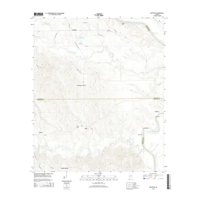
2014 Map of Whitfield
USGS Topo · Published 2014About this map
The Tombigbee River meanders along the eastern border of this Alabama landscape, defining the intersection of Sumter, Choctaw, and Marengo counties. This riverine environment is marked by prominent landmarks such as Turkey Shoals and Black Bluff, with the modern Coffeeville Lake reaching into the valley. Traces of historical industry and transit appear through the Old Sante Fe RR Rd and the American-Can Company Lake, suggesting the area's legacy of timber and rail commerce.
Find a feature on this map
46 named features on this map. Tap any name to fly to it.
Don’t see what you’re looking for? This feature index may not catch every label — zoom into the map to look around manually.
Map Details
Editions of this 2014 Whitfield Map
This is the sole edition of this map. No revisions or reprints were ever made.
Other maps of this area

1953 · Montgomery
USGS Topo · 1:250,000

1953 · Meridian
USGS Topo · 1:250,000

1956 · Montgomery
USGS Topo · 1:250,000

1957 · Meridian
USGS Topo · 1:250,000

1957 · Montgomery
USGS Topo · 1:250,000

1965 · Meridian
USGS Topo · 1:250,000

1970 · Myrtlewood North
USGS Topo · 1:24,000
1970 · Jefferson
USGS Topo · 1:24,000

1971 · Whitfield
USGS Topo · 1:24,000

1971 · Coatopa
USGS Topo · 1:24,000