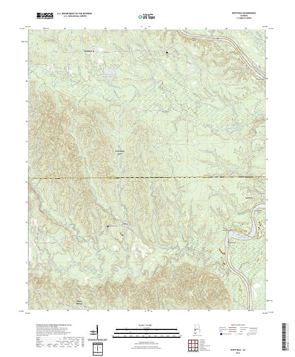
2024 Map of Whitfield
USGS Topo · Published 2024About this map
The Tombigbee River forms a dominant natural boundary along the eastern edge of this Alabama landscape, where the confluence of Double Creek and Cotohaga Creek meets the river's winding path near Turkey Shoals. Small settlements such as Whitfield, Persimmon Grove, and Edna are scattered across the interior, connected by rural routes like Boll Weevil Rd and CCC Rd. The mapping of family and community landmarks, including Black Bluff Cem and Bethlehem Cem, provides essential points of reference for genealogical research in this rural corridor.
Find a feature on this map
50 named features on this map. Tap any name to fly to it.
Don’t see what you’re looking for? This feature index may not catch every label — zoom into the map to look around manually.
Map Details
Editions of this 2024 Whitfield Map
This is the sole edition of this map. No revisions or reprints were ever made.
Other maps of this area

1953 · Montgomery
USGS Topo · 1:250,000

1953 · Meridian
USGS Topo · 1:250,000

1956 · Montgomery
USGS Topo · 1:250,000

1957 · Meridian
USGS Topo · 1:250,000

1957 · Montgomery
USGS Topo · 1:250,000

1965 · Meridian
USGS Topo · 1:250,000

1970 · Myrtlewood North
USGS Topo · 1:24,000
1970 · Jefferson
USGS Topo · 1:24,000

1971 · Whitfield
USGS Topo · 1:24,000

1971 · Coatopa
USGS Topo · 1:24,000