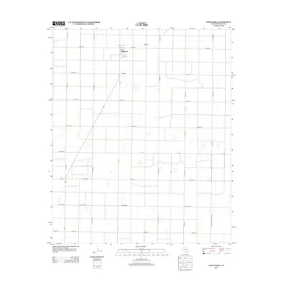
2012 Map of Whitharral
USGS Topo · Published 2012About this map
The unincorporated community of Whitharral serves as the focal point of this high plains agricultural landscape in Hockley County. Established on a grid of early 20th-century roads named for distant states and cities, the settlement is positioned near the junction of Farm-to-market Road 2646 and several local routes including 2nd St and 6th St. The layout reflects the area's development into a systematic farming region, where long, straight thoroughfares like Atlanta Rd, N Alamo Rd, and Dallas Rd define the property boundaries and transport corridors of the Llano Estacado. Genealogy and local history researchers will find the Whitharral Cem clearly marked northeast of the town center, providing a vital point of reference for families of the district. The map also traces the critical network of state-maintained roads, such as FM-1294 and FM-2306, which have long connected these remote cotton and grain fields to the larger regional economy.
Find a feature on this map
26 named features on this map. Tap any name to fly to it.
Don’t see what you’re looking for? This feature index may not catch every label — zoom into the map to look around manually.
Map Details
Editions of this 2012 Whitharral Map
This is the sole edition of this map. No revisions or reprints were ever made.
Other maps of this area

1954 · Brownfield
USGS Topo · 1:250,000

1957 · Anton
USGS Topo · 1:62,500

1957 · Wolfforth
USGS Topo · 1:62,500

1958 · Brownfield
USGS Topo · 1:250,000

1962 · Brownfield
USGS Topo · 1:250,000

1964 · Oklahoma Flat
USGS Topo · 1:24,000

1964 · Lums Chapel
USGS Topo · 1:24,000

1964 · Whitharral
USGS Topo · 1:24,000

1965 · Levelland West
USGS Topo · 1:24,000

1965 · Levelland East
USGS Topo · 1:24,000