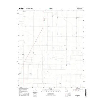
2016 Map of Whitharral
USGS Topo · Published 2016About this map
Whitharral serves as the central hub for this portion of the Texas High Plains, situated at the intersection of a vast grid of farm-to-market and county roads. The settlement is anchored by a Po and the nearby Whitharral Cem, reflecting the deep-rooted agricultural community of Hockley County. The landscape is primarily defined by the seasonal drainage of Yellow House Draw, which winds through the northwest corner of the quadrangle. The map illustrates a highly organized rural infrastructure, with roads named for states and international locations such as Kansas Rd, Dallas Rd, and Georgia Rd. These straight-line thoroughfares, including FM 1294 and FM 2306, facilitate the movement of goods across a region marked by numerous small depressions and playas, highlighting the importance of water management in this semi-arid environment.
Find a feature on this map
28 named features on this map. Tap any name to fly to it.
Don’t see what you’re looking for? This feature index may not catch every label — zoom into the map to look around manually.
Map Details
Editions of this 2016 Whitharral Map
This is the sole edition of this map. No revisions or reprints were ever made.
Other maps of this area

1954 · Brownfield
USGS Topo · 1:250,000

1957 · Anton
USGS Topo · 1:62,500

1957 · Wolfforth
USGS Topo · 1:62,500

1958 · Brownfield
USGS Topo · 1:250,000

1962 · Brownfield
USGS Topo · 1:250,000

1964 · Oklahoma Flat
USGS Topo · 1:24,000

1964 · Lums Chapel
USGS Topo · 1:24,000

1964 · Whitharral
USGS Topo · 1:24,000

1965 · Levelland West
USGS Topo · 1:24,000

1965 · Levelland East
USGS Topo · 1:24,000