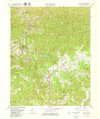
1979 Map of Whitley City
USGS Topo · Published 1979About this map
The Southern rail corridor anchors the communities of McCreary County in the late 1970s, threading through Whitley City, Stearns, and Pine Knot. This landscape within the Daniel Boone National Forest shows a complex transition from industrial activity to federal management. In the southern reaches, active strip mines operate near Strunk, contrasting with the established municipal infrastructure of the McCreary County Airport and the Pine Knot Job Corps Center.
Find a feature on this map
54 named features on this map. Tap any name to fly to it.
Don’t see what you’re looking for? This feature index may not catch every label — zoom into the map to look around manually.
Map Details
Editions of this 1979 Whitley City Map
2 editions found
Other maps of this area

1890 · Williamsburg
USGS Topo · 1:125,000

1894 · Williamsburg
USGS Topo · 1:125,000

1932 · Burnside
USGS Topo · 1:62,500

1934 · Barthell
USGS Topo · 1:62,500

1952 · Hollyhill
USGS Topo · 1:24,000

1952 · Wiborg
USGS Topo · 1:24,000

1952 · Cumberland Falls
USGS Topo · 1:24,000

1952 · Whitley City
USGS Topo · 1:24,000
1953 · Winfield
USGS Topo · 1:24,000
1953 · Ketchen
USGS Topo · 1:24,000