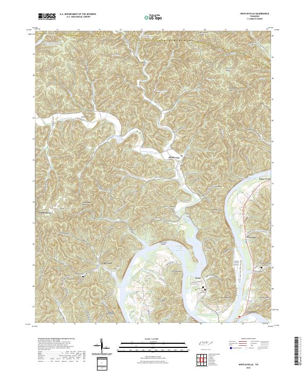
2022 Map of Whitleyville
USGS Topo · Published 2022About this map
Whitleyville and the winding course of Jennings Creek define this section of Jackson County, where the Cumberland River valley has been transformed by the Cordell Hull Reservoir. The landscape is a complex of deep hollows and high points like Chimney Knob and Buzzard Bluff Knob, illustrating the traditional upland settlement patterns of the Highland Rim. Smaller communities such as Stone, Hurricane, and Haydenburg are connected by narrow roads following the creek beds and ridges, including Old State Rte 85. Genealogists will find numerous family-linked locations and burial sites, from Cub Creek Cem to the Draper-Naff Cem. The map also details modern infrastructure like the Jackson County Airport situated on the banks above the reservoir, contrasting with the many named gaps and hollows like Moccasin Gap and Sloan Hollow that have shaped local travel for generations.
Find a feature on this map
104 named features on this map. Tap any name to fly to it.
Don’t see what you’re looking for? This feature index may not catch every label — zoom into the map to look around manually.
Map Details
Editions of this 2022 Whitleyville Map
This is the sole edition of this map. No revisions or reprints were ever made.
Other maps of this area

1925 · Gainesboro
USGS Topo · 1:62,500

1929 · Gainesboro
USGS Topo · 1:62,500

1929 · Tompkinsville
USGS Topo · 1:62,500

1931 · Red Boiling Springs
USGS Topo · 1:62,500

1932 · Carthage
USGS Topo · 1:62,500

1956 · Corbin
USGS Topo · 1:250,000

1958 · Corbin
USGS Topo · 1:250,000
1968 · Dodson Branch
USGS Topo · 1:24,000
1968 · Willette
USGS Topo · 1:24,000
1968 · Burristown
USGS Topo · 1:24,000