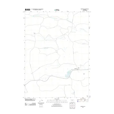
2011 Map of Whitman
USGS Topo · Published 2011About this map
Whitman serves as the primary settlement hub in this 2011 survey of western Nebraska. Located amidst the characteristic terrain of the Sand Hills, the community is centered around the Whitman Post Office and local infrastructure like the Whitman Towers. The landscape is defined by its water systems and ranching history, with the South Branch Middle Loup River winding through the northern portion of the quadrangle and Doc Lake situated just west of the town center. The presence of Monahan Ranch highlights the region's enduring agricultural identity. A network of rural roads, including N Whitman Rd and Collins Rd, provides access across this sparsely populated section of Grant County, linking isolated ranch sites to the small town center along the railroad corridor.
Find a feature on this map
16 named features on this map. Tap any name to fly to it.
Don’t see what you’re looking for? This feature index may not catch every label — zoom into the map to look around manually.
Map Details
Editions of this 2011 Whitman Map
This is the sole edition of this map. No revisions or reprints were ever made.
Other maps of this area

1948 · Carr Lake
USGS Topo · 1:62,500

1948 · Whitman
USGS Topo · 1:62,500

1948 · Spring Valley
USGS Topo · 1:62,500

1950 · Spring Valley
USGS Topo · 1:62,500

1950 · Whitman
USGS Topo · 1:62,500

1950 · Carr Lake
USGS Topo · 1:62,500

1950 · Hire
USGS Topo · 1:62,500

1954 · North Platte
USGS Topo · 1:250,000

1956 · North Platte
USGS Topo · 1:250,000

1957 · North Platte
USGS Topo · 1:250,000