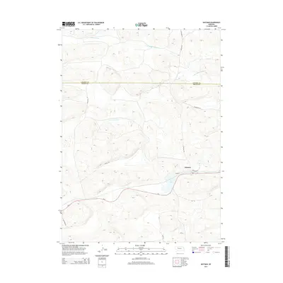
2014 Map of Whitman
USGS Topo · Published 2014About this map
The unincorporated community of Whitman sits along the southern edge of the Sandhills, serving as a focal point for this landscape of interdunal valleys and wetlands. The central settlement is marked by its Po and a small grid of streets including Weaver St and E Weaver St, positioned where the Ne-2 highway traverses the region. To the north, the terrain is defined by the winding course of the S Br Middle Loup River, which cuts across the Cherry Co and Grant Co boundary. The map reveals a network of rural access points like Circle Dot Dr and Gudmundsun Rd, reflecting the ranching operations that characterize the local economy. Water features such as Doc Lake underscore the hydrological complexity of the area, where groundwater-fed lakes and rivers are essential to the life of the High Plains.
Find a feature on this map
17 named features on this map. Tap any name to fly to it.
Don’t see what you’re looking for? This feature index may not catch every label — zoom into the map to look around manually.
Map Details
Editions of this 2014 Whitman Map
This is the sole edition of this map. No revisions or reprints were ever made.
Other maps of this area

1948 · Carr Lake
USGS Topo · 1:62,500

1948 · Whitman
USGS Topo · 1:62,500

1948 · Spring Valley
USGS Topo · 1:62,500

1950 · Spring Valley
USGS Topo · 1:62,500

1950 · Whitman
USGS Topo · 1:62,500

1950 · Carr Lake
USGS Topo · 1:62,500

1950 · Hire
USGS Topo · 1:62,500

1954 · North Platte
USGS Topo · 1:250,000

1956 · North Platte
USGS Topo · 1:250,000

1957 · North Platte
USGS Topo · 1:250,000