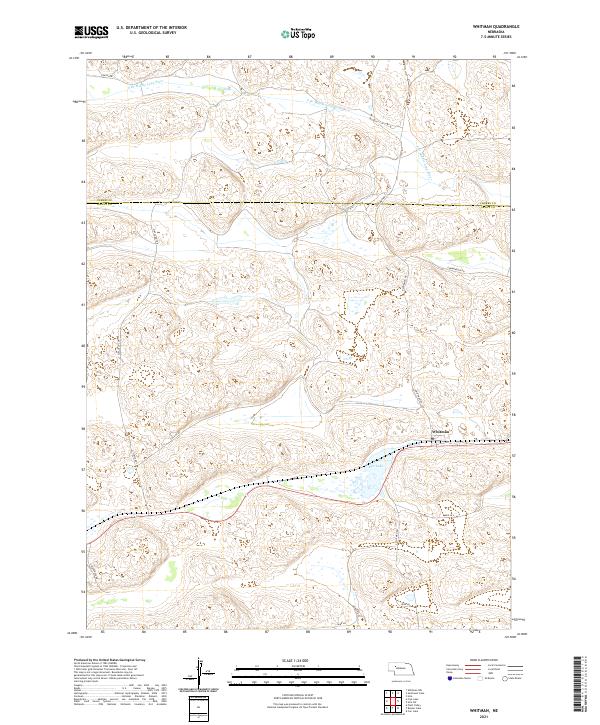
2021 Map of Whitman
USGS Topo · Published 2021About this map
Whitman anchors this portion of the Nebraska Sandhills, serving as a primary point of settlement where local routes converge north of Doc Lake. The landscape is defined by the hydrologic patterns of the S Br Middle Loup River in the north and numerous unnamed depressions and wetlands characteristic of Grant County. A network of rural roads, including Gudmundsen Rd and Circle Dot Dr, suggests a ranching economy organized around the Public Land Survey System sections. The boundary between Cherry County and Grant County is clearly delineated, marking a transition in local jurisdiction across this sparsely populated prairie terrain. Transportation through the area follows established corridors like N Whitman Rd and S Whitman Rd, which link remote homesteads to the central community.
Find a feature on this map
21 named features on this map. Tap any name to fly to it.
Don’t see what you’re looking for? This feature index may not catch every label — zoom into the map to look around manually.
Map Details
Editions of this 2021 Whitman Map
This is the sole edition of this map. No revisions or reprints were ever made.
Other maps of this area

1948 · Carr Lake
USGS Topo · 1:62,500

1948 · Whitman
USGS Topo · 1:62,500

1948 · Spring Valley
USGS Topo · 1:62,500

1950 · Spring Valley
USGS Topo · 1:62,500

1950 · Whitman
USGS Topo · 1:62,500

1950 · Carr Lake
USGS Topo · 1:62,500

1950 · Hire
USGS Topo · 1:62,500

1954 · North Platte
USGS Topo · 1:250,000

1956 · North Platte
USGS Topo · 1:250,000

1957 · North Platte
USGS Topo · 1:250,000