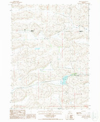
1987 Map of Whitman
USGS Topo · Published 1988About this map
Whitman serves as the primary hub in this late-1980s Nebraska landscape, situated along the Burlington Northern line and the edge of the Cherry Co - Grant Co boundary. The area is characterized by the expansive grazing lands of the Sandhills, anchored by the Monahan Ranch and framed by the natural depressions of Long Valley. Local infrastructure and landmarks include the Whitman Towers and a local Cem, providing specific points of interest for genealogists tracing family roots in this ranching country. The hydrological landscape is defined by the South Branch Middle Loup River in the northeast corner and the prominent Doc Lake, reflecting the vital relationship between water sources and livestock operations in this portion of the Nebraska panhandle.
Find a feature on this map
9 named features on this map. Tap any name to fly to it.
Don’t see what you’re looking for? This feature index may not catch every label — zoom into the map to look around manually.
Map Details
Editions of this 1987 Whitman Map
This is the sole edition of this map. No revisions or reprints were ever made.
Other maps of this area

1948 · Carr Lake
USGS Topo · 1:62,500

1948 · Whitman
USGS Topo · 1:62,500

1948 · Spring Valley
USGS Topo · 1:62,500

1950 · Spring Valley
USGS Topo · 1:62,500

1950 · Whitman
USGS Topo · 1:62,500

1950 · Carr Lake
USGS Topo · 1:62,500

1950 · Hire
USGS Topo · 1:62,500

1954 · North Platte
USGS Topo · 1:250,000

1956 · North Platte
USGS Topo · 1:250,000

1957 · North Platte
USGS Topo · 1:250,000