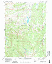
1972 Map of Whitney Reservoir
USGS Topo · Published 1980About this map
Wasatch National Forest dominates this high-altitude landscape, centered on the Whitney Reservoir and the headwaters of the West Fork Bear River. Surveyed in the early 1970s, the map reveals a remote mountainous terrain defined by deep glacial basins and high summits like Moffit Peak and Humpy Peak. The land is networked by specialized transportation routes, including a Pack Trail through Moffit Pass and numerous Jeep Trail tracks providing access to high-country meadows.
Find a feature on this map
35 named features on this map. Tap any name to fly to it.
Don’t see what you’re looking for? This feature index may not catch every label — zoom into the map to look around manually.
Map Details
Editions of this 1972 Whitney Reservoir Map
3 editions found
Other maps of this area

1885 · Salt Lake
USGS Topo · 1:250,000

1885 · Uinta
USGS Topo · 1:250,000

1900 · Coalville
USGS Topo · 1:125,000

1901 · Hayden Peak
USGS Topo · 1:125,000

1903 · Hayden Peak
USGS Topo · 1:125,000

1903 · Coalville
USGS Topo · 1:125,000

1954 · Salt Lake City
USGS Topo · 1:250,000

1958 · Salt Lake City
USGS Topo · 1:250,000

1960 · Salt Lake City
USGS Topo · 1:250,000
1972 · Seven Tree Flat
USGS Topo · 1:24,000