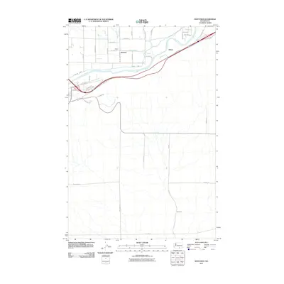
2011 Map of Whitstran
USGS Topo · Published 2011About this map
Whitstran and the surrounding irrigation landscape of Benton County are defined by the winding course of the Yakima River and the engineered systems that support local agriculture. In the early 21st century, the area shows a distinct grid of rural roads and canals, such as the Chandler Canal and the Prosser East Lateral, which snake through the terrain to service the valley's farms. Small settlements like Gibbon and Biggam sit north of the river, while the land to the south transitions into more open acreage, punctuated by landmarks like the Davis Ranch. This survey captures the infrastructure of the Yakima Valley, including the W Old Inland Empire Hwy and Wine Country Rd, illustrating how the region's transport and water management have shaped its development as a viticultural and farming hub.
Find a feature on this map
43 named features on this map. Tap any name to fly to it.
Don’t see what you’re looking for? This feature index may not catch every label — zoom into the map to look around manually.
Map Details
Editions of this 2011 Whitstran Map
This is the sole edition of this map. No revisions or reprints were ever made.
Other maps of this area

1915 · Prosser
USGS Topo · 1:125,000

1917 · Prosser
USGS Topo · 1:125,000

1950 · Grandview
USGS Topo · 1:62,500

1951 · Grandview
USGS Topo · 1:62,500

1951 · Corral Canyon
USGS Topo · 1:62,500

1953 · Walla Walla
USGS Topo · 1:250,000

1958 · Walla Walla
USGS Topo · 1:250,000

1965 · Whitstran
USGS Topo · 1:62,500
1965 · Prosser
USGS Topo · 1:62,500
1965 · Prosser SE
USGS Topo · 1:24,000