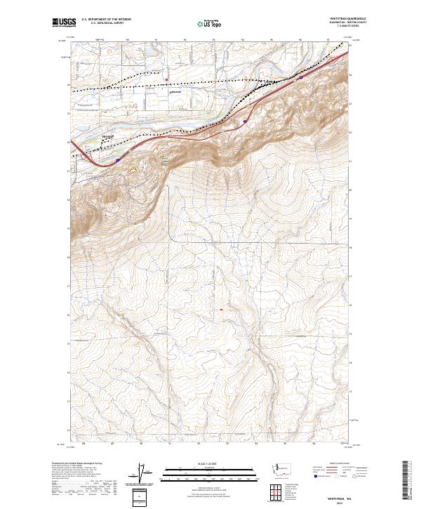
2023 Map of Whitstran
USGS Topo · Published 2023About this map
Prosser anchors this portion of the Yakima Valley, where irrigation and agriculture define the landscape. The Chandler Canal parallels the Yakima River, feeding the orchards and vineyards that thrive between the riverbed and the rising slopes of the Horse Heaven Hills. The map details the transition from the concentrated settlement at Whitstran to the expansive rangelands and dryland farming areas to the south. Local transit and heritage are traced through names like Old Inland Empire Hwy and Wine Country Rd, which highlight the area's long-standing role as a corridor for both travel and viticulture. Smaller waterways such as Snipes Creek and Spring Creek cut through the northern agricultural flats, while to the east, the small junction of Gibbon sits near the river's bend. The southern half of the sheet is dominated by the steep ascent into the hills, marked by utility roads and rural routes like Williamson Rd and Cemetery Rd.
Find a feature on this map
26 named features on this map. Tap any name to fly to it.
Don’t see what you’re looking for? This feature index may not catch every label — zoom into the map to look around manually.
Map Details
Editions of this 2023 Whitstran Map
This is the sole edition of this map. No revisions or reprints were ever made.
Other maps of this area

1915 · Prosser
USGS Topo · 1:125,000

1917 · Prosser
USGS Topo · 1:125,000

1950 · Grandview
USGS Topo · 1:62,500

1951 · Grandview
USGS Topo · 1:62,500

1951 · Corral Canyon
USGS Topo · 1:62,500

1953 · Walla Walla
USGS Topo · 1:250,000

1958 · Walla Walla
USGS Topo · 1:250,000

1965 · Whitstran
USGS Topo · 1:62,500
1965 · Prosser
USGS Topo · 1:62,500
1965 · Prosser SE
USGS Topo · 1:24,000