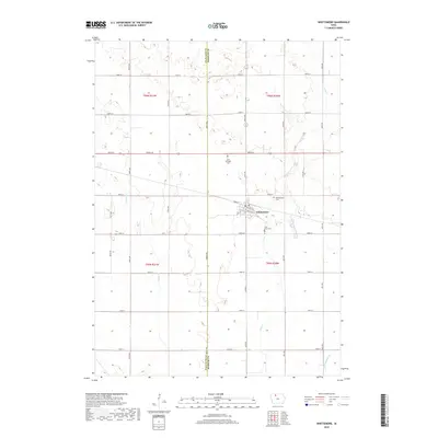
2018 Map of Whittemore
USGS Topo · Published 2018About this map
The town of Whittemore serves as the central hub of this agricultural landscape along the border of Palo Alto and Kossuth counties. This 2018 survey reveals a meticulously organized grid of section-line roads, including Works Rd, 220th St, and 580th Ave, that navigate the drainage patterns of the region. The map highlights the essential local heritage found in three distinct burial grounds: Saint Michaels Cem to the northwest of town, and both Whittemore Cem and Saint Pauls Cem situated closer to the settlement's core. Water management is a defining characteristic of the terrain, visible through the meandering paths of Lotts Cr and Prairie Cr, as well as the engineered flow of Ditch Number 79, reflecting the region's long-standing commitment to productive prairie farmland.
Find a feature on this map
44 named features on this map. Tap any name to fly to it.
Don’t see what you’re looking for? This feature index may not catch every label — zoom into the map to look around manually.
Map Details
Editions of this 2018 Whittemore Map
This is the sole edition of this map. No revisions or reprints were ever made.
Other maps of this area

1954 · Fairmont
USGS Topo · 1:250,000

1954 · Fort Dodge
USGS Topo · 1:250,000

1957 · Fort Dodge
USGS Topo · 1:250,000

1958 · Fort Dodge
USGS Topo · 1:250,000

1958 · Fairmont
USGS Topo · 1:250,000

1980 · Lone Rock
USGS Topo · 1:24,000

1980 · Fenton
USGS Topo · 1:24,000

1980 · Depew
USGS Topo · 1:24,000

1980 · Plover
USGS Topo · 1:24,000

1980 · Hobarton
USGS Topo · 1:24,000