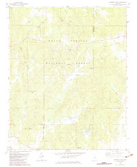
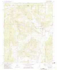
1982 Map of Whitten Town
USGS Topo · Published 1983About this map
The rolling woodlands of the Holly Springs National Forest define this 1980s landscape along the border of Benton and Tippah Counties. Small family and community landmarks are scattered throughout the hills, including the Whitten Town settlement and numerous country churches such as New Hope Ch, Blackwell Ch, and Friendship Ch. The terrain is deeply dissected by a network of small waterways including Shelby Creek, Indian Creek, and Yellow Rabbit Creek, which feed into the Tippah R. For genealogists, the map is particularly rich in burial sites, noting the Tate Cem, Hopkins Cem, and Ormans Cem among others. Industry is limited to scattered Sandpits and the Crawford Lookout Tower, reflecting a rural economy centered on forestry and small-scale agriculture at the time of the 1978 field check.
Find a feature on this map
39 named features on this map. Tap any name to fly to it.
Don’t see what you’re looking for? This feature index may not catch every label — zoom into the map to look around manually.
Map Details
Editions of this 1982 Whitten Town Map
This is the sole edition of this map. No revisions or reprints were ever made.
Other maps of this area

1950 · Ashland
USGS Topo · 1:62,500

1951 · Walnut
USGS Topo · 1:62,500

1955 · Ripley
USGS Topo · 1:62,500

1955 · Blue Mountain
USGS Topo · 1:62,500

1956 · Tupelo
USGS Topo · 1:250,000

1958 · Tupelo
USGS Topo · 1:250,000
1982 · Ripley
USGS Topo · 1:24,000
1982 · Blue Mountain
USGS Topo · 1:24,000
1982 · Chilli Creek
USGS Topo · 1:24,000
1982 · Walnut
USGS Topo · 1:24,000