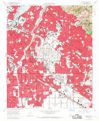
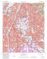
1965 Map of Whittier
USGS Topo · Published 1967About this map
The San Gabriel River and Rio Hondo define the western landscape of this mid-1960s Los Angeles County survey, where suburban expansion meets the foothills of the Puente Hills. The area shows a dense concentration of educational and medical institutions, including Whittier College, Biola College, and the sprawling grounds of the Metropolitan State Hospital. Large-scale land use is further evidenced by the massive Rose Hills Memorial Park and the Whittier Narrows Recreation Area in the northwest.
Find a feature on this map
50 named features on this map. Tap any name to fly to it.
Don’t see what you’re looking for? This feature index may not catch every label — zoom into the map to look around manually.
Map Details
Editions of this 1965 Whittier Map
5 editions found
Other maps of this area

1894 · Los Angeles
USGS Topo · 1:62,500

1894 · Pomona
USGS Topo · 1:62,500

1896 · Pasadena
USGS Topo · 1:62,500

1896 · Anaheim
USGS Topo · 1:62,500

1896 · Downey
USGS Topo · 1:62,500

1897 · Pomona
USGS Topo · 1:62,500

1898 · Pomona
USGS Topo · 1:62,500

1898 · Anaheim
USGS Topo · 1:62,500

1899 · Downey
USGS Topo · 1:62,500

1900 · Pasadena
USGS Topo · 1:62,500