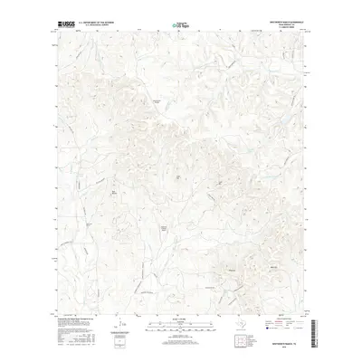
2016 Map of Whitworth Ranch
USGS Topo · Published 2016About this map
Blanco River headwaters and a series of rugged limestone uplands define this portion of the Texas Hill Country near Whitworth Ranch. The landscape is etched by a complex drainage network where the S Fork Blanco River meets tributaries like Blackberry Cr and Delaware Cr. This 2016 survey illustrates the modern ranching and aviation footprint of the region, featuring private facilities like Headwaters Airport and Diamond K Ranch Airport set against prominent topographic landmarks such as Wolf Mtn, Meta Mtn, and the distinctive Bust Buttes. Local springs, including Wenzel Spring and Delaware Spring, suggest the underlying karst hydrology that has historically sustained these remote uplands. The road network, including Upper Sisterdale Rd and Habenicht-Fischer Rd, follows the winding contours of the creek valleys, connecting isolated ranching properties across Kendall County.
Find a feature on this map
48 named features on this map. Tap any name to fly to it.
Don’t see what you’re looking for? This feature index may not catch every label — zoom into the map to look around manually.
Map Details
Editions of this 2016 Whitworth Ranch Map
This is the sole edition of this map. No revisions or reprints were ever made.
Other maps of this area

1894 · Fredericksburg
USGS Topo · 1:125,000

1954 · Llano
USGS Topo · 1:250,000

1954 · San Antonio
USGS Topo · 1:250,000

1955 · Llano
USGS Topo · 1:250,000

1956 · Comfort
USGS Topo · 1:62,500

1956 · Llano
USGS Topo · 1:250,000

1957 · Boerne
USGS Topo · 1:62,500

1957 · San Antonio
USGS Topo · 1:250,000

1961 · Stonewall
USGS Topo · 1:24,000

1961 · Hye
USGS Topo · 1:24,000