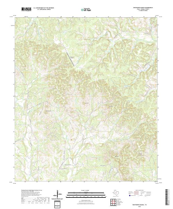
2022 Map of Whitworth Ranch
USGS Topo · Published 2022About this map
Whitworth serves as a central anchor in this high-altitude pocket of the Texas Hill Country, where the upper reaches of the Blanco River and S Fork Blanco River begin to carve through the limestone landscape. The terrain is defined by prominent elevations such as Wolf Mtn, Meta Mtn, and the distinctive Bust Buttes, which likely served as long-standing local landmarks for early travelers and ranchers. The presence of several reliable water sources, including Wenzel Spring, Delaware Spring, and Carson Spring, suggests a historical reliance on these points for livestock and settlement in an otherwise well-drained upland environment. The road network, including Ranch Rd 1376 and FM 1888, traces the winding topography, while the Headwaters Airport indicates more contemporary aviation use in this ranching-heavy district.
Find a feature on this map
48 named features on this map. Tap any name to fly to it.
Don’t see what you’re looking for? This feature index may not catch every label — zoom into the map to look around manually.
Map Details
Editions of this 2022 Whitworth Ranch Map
This is the sole edition of this map. No revisions or reprints were ever made.
Other maps of this area

1894 · Fredericksburg
USGS Topo · 1:125,000

1954 · Llano
USGS Topo · 1:250,000

1954 · San Antonio
USGS Topo · 1:250,000

1955 · Llano
USGS Topo · 1:250,000

1956 · Comfort
USGS Topo · 1:62,500

1956 · Llano
USGS Topo · 1:250,000

1957 · Boerne
USGS Topo · 1:62,500

1957 · San Antonio
USGS Topo · 1:250,000

1961 · Stonewall
USGS Topo · 1:24,000

1961 · Hye
USGS Topo · 1:24,000