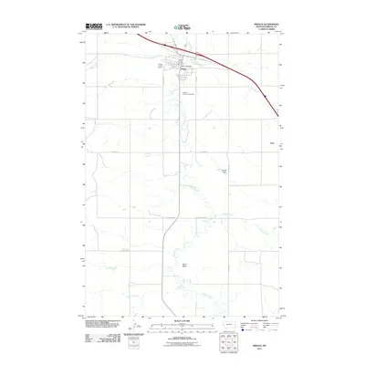
2011 Map of Wibaux
USGS Topo · Published 2011About this map
Wibaux serves as the focal point of this Eastern Montana landscape, situated where Beaver Creek meanders through the high plains. The town is defined by a grid of streets including 1st Ave S and James St, housing essential civic landmarks like the Wibaux Post Office and the Wibaux Co Vol Fire Dept. Outside the residential center, the Wibaux County Fairgrounds and the Wibaux County Cemetery mark the community's social and historical boundaries.
Find a feature on this map
22 named features on this map. Tap any name to fly to it.
Don’t see what you’re looking for? This feature index may not catch every label — zoom into the map to look around manually.
Map Details
Editions of this 2011 Wibaux Map
This is the sole edition of this map. No revisions or reprints were ever made.
Other maps of this area

1909 · Glendive
USGS Topo · 1:250,000

1953 · Miles City
USGS Topo · 1:250,000

1954 · Glendive
USGS Topo · 1:250,000

1957 · Miles City
USGS Topo · 1:250,000

1957 · Glendive
USGS Topo · 1:250,000

1958 · Miles City
USGS Topo · 1:250,000

1958 · Glendive
USGS Topo · 1:250,000
1974 · Odland Dam
USGS Topo · 1:24,000

1981 · Glendive
USGS Topo · 1:100,000

1981 · Wibaux
USGS Topo · 1:100,000