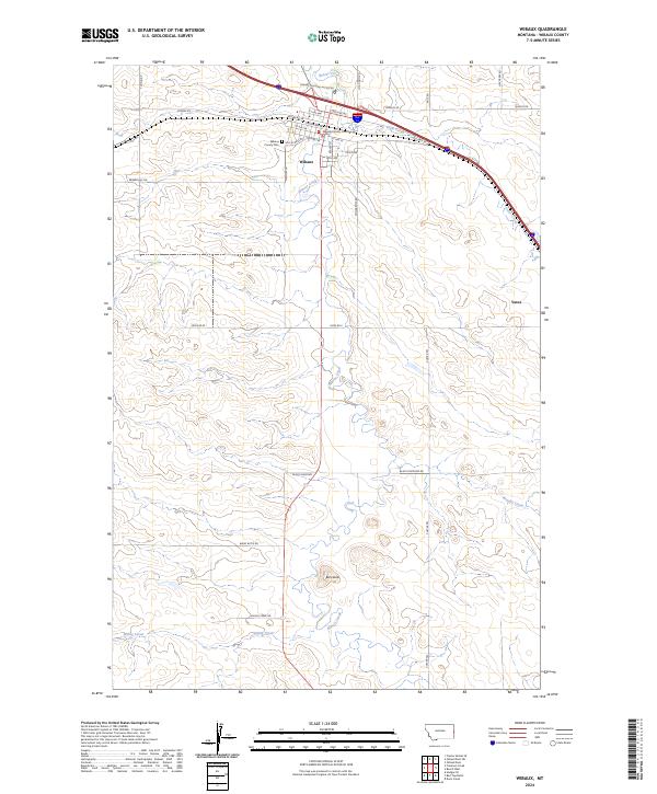
2024 Map of Wibaux
USGS Topo · Published 2024About this map
Wibaux serves as the focal point of this eastern Montana landscape, where the confluence of Beaver Creek and several seasonal drainages defines the local geography. The town layout is clearly delineated, showing the Wibaux County Courthouse as a central landmark and the nearby Wibaux County Cem on the western edge. Settlement patterns follow the winding path of the creek and the established transportation corridors, including the path of Old Hwy 10.
Find a feature on this map
41 named features on this map. Tap any name to fly to it.
Don’t see what you’re looking for? This feature index may not catch every label — zoom into the map to look around manually.
Map Details
Editions of this 2024 Wibaux Map
This is the sole edition of this map. No revisions or reprints were ever made.
Other maps of this area

1909 · Glendive
USGS Topo · 1:250,000

1953 · Miles City
USGS Topo · 1:250,000

1954 · Glendive
USGS Topo · 1:250,000

1957 · Miles City
USGS Topo · 1:250,000

1957 · Glendive
USGS Topo · 1:250,000

1958 · Miles City
USGS Topo · 1:250,000

1958 · Glendive
USGS Topo · 1:250,000
1974 · Odland Dam
USGS Topo · 1:24,000

1981 · Glendive
USGS Topo · 1:100,000

1981 · Wibaux
USGS Topo · 1:100,000