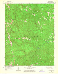
1963 Map of Wiborg
USGS Topo · Published 1966About this map
Cumberland National Forest dominates this landscape in southern Kentucky, where the Southern Railway serves a string of coal-country settlements. The map documents the mid-century spatial organization of McCreary County, from the rail stop at Parkers Lake to the eastern outpost of Honeybee. The terrain is defined by deep incisions like Windlass Hollow and Franklin Hollow, while high ground supports community life at Beulah Heights and Flat Rock.
Find a feature on this map
61 named features on this map. Tap any name to fly to it.
Don’t see what you’re looking for? This feature index may not catch every label — zoom into the map to look around manually.
Map Details
Editions of this 1963 Wiborg Map
3 editions found
Other maps of this area

1890 · Williamsburg
USGS Topo · 1:125,000

1894 · Williamsburg
USGS Topo · 1:125,000

1932 · Burnside
USGS Topo · 1:62,500

1934 · Barthell
USGS Topo · 1:62,500

1952 · Hail
USGS Topo · 1:24,000

1952 · Hollyhill
USGS Topo · 1:24,000

1952 · Wiborg
USGS Topo · 1:24,000

1952 · Cumberland Falls
USGS Topo · 1:24,000

1952 · Whitley City
USGS Topo · 1:24,000
1952 · Sawyer
USGS Topo · 1:24,000