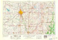
1955 Map of Wichita
USGS Topo · Published 1967About this map
Wichita sits at the confluence of the Arkansas River and Little Arkansas River, serving as a major regional hub during the mid-20th century. This survey documents the post-war expansion of the city, including the establishment of McConnell AFB and the growth of surrounding communities like Derby, Haysville, and Valley Center. The landscape is defined by the agricultural and industrial activities of the Flint Hills and the Arkansas River Valley, with numerous Oil Fields scattered across Butler and Greenwood counties.
Find a feature on this map
289 named features on this map. Tap any name to fly to it.
Don’t see what you’re looking for? This feature index may not catch every label — zoom into the map to look around manually.
Map Details
Editions of this 1955 Wichita Map
3 editions found

Other maps of this area

1885 · Burlington
USGS Topo · 1:125,000

1885 · Eureka
USGS Topo · 1:125,000

1885 · Sedan
USGS Topo · 1:125,000

1886 · Fredonia
USGS Topo · 1:125,000

1886 · Independence
USGS Topo · 1:125,000

1888 · Emporia
USGS Topo · 1:125,000

1888 · Eureka
USGS Topo · 1:125,000

1888 · Eldorado
USGS Topo · 1:125,000

1889 · Newton
USGS Topo · 1:125,000

1889 · Burden
USGS Topo · 1:125,000