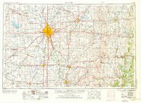
1955 Map of Wichita
USGS Topo · Published 1976About this map
Wichita serves as the central hub of this mid-century survey, shown just as its metropolitan footprint was expanding alongside the critical operations at McConnell AFB. The landscape is a complex intersection of the old river-and-rail economy and the modernizing interstate system, featuring the Kansas Turnpike and the massive Cheney Reservoir. To the east, the Flint Hills begin to break the grid of the agricultural plains, while the confluence of the Arkansas River and Little Arkansas River remains the focal point for settlement growth.
Find a feature on this map
131 named features on this map. Tap any name to fly to it.
Don’t see what you’re looking for? This feature index may not catch every label — zoom into the map to look around manually.
Map Details
Editions of this 1955 Wichita Map
3 editions found

Other maps of this area

1885 · Burlington
USGS Topo · 1:125,000

1885 · Eureka
USGS Topo · 1:125,000

1885 · Sedan
USGS Topo · 1:125,000

1886 · Fredonia
USGS Topo · 1:125,000

1886 · Independence
USGS Topo · 1:125,000

1888 · Emporia
USGS Topo · 1:125,000

1888 · Eureka
USGS Topo · 1:125,000

1888 · Eldorado
USGS Topo · 1:125,000

1889 · Newton
USGS Topo · 1:125,000

1889 · Burden
USGS Topo · 1:125,000