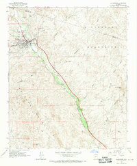
1964 Map of Wickenburg
USGS Topo · Published 1970About this map
The Hassayampa River valley serves as the primary corridor for development and transport in this mid-1960s Arizona survey. The town of Wickenburg is shown with its local infrastructure including a High Sch, Hospital, and Cem, while the Atchison Topeka and Santa Fe railroad parallels the river's path southeast toward the settlement of Allah. The desert landscape is defined by the Vulture Mountains and Wickenburg Mountains, where resource extraction is evident at the Dragon Mine and Mammoth Spar Mine. Aviation and recreation are also represented by the Ramuda Ranch Landing Strip and Roadside Park, illustrating how the region's economy integrated mining, transportation, and early tourism around water sources like Palm Lake.
Find a feature on this map
32 named features on this map. Tap any name to fly to it.
Don’t see what you’re looking for? This feature index may not catch every label — zoom into the map to look around manually.
Map Details
Editions of this 1964 Wickenburg Map
4 editions found
Other maps of this area

1887 · Prescott
USGS Topo · 1:250,000

1892 · Prescott
USGS Topo · 1:250,000

1903 · Congress
USGS Topo · 1:125,000

1904 · Congress
USGS Topo · 1:125,000

1947 · Wagoner
USGS Topo · 1:62,500

1948 · Wagoner
USGS Topo · 1:63,360

1950 · Wagoner
USGS Topo · 1:62,500

1950 · Prescott
USGS Topo · 1:250,000

1954 · Prescott
USGS Topo · 1:250,000

1954 · Phoenix
USGS Topo · 1:250,000