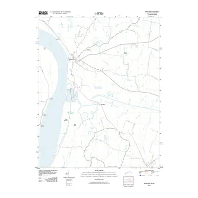
2010 Map of Wickliffe
USGS Topo · Published 2010About this map
Wickliffe sits at a strategic bend where the Mississippi River creates a complex network of waterways and low-lying islands along the Kentucky-Missouri border. The landscape is defined by the significant hydrological influence of the river, which has carved out Island Number 1, Cane Island, and the Island Number 1 Chute. Historical river commerce is evidenced by landing sites such as Norfolk Landing and Pritchard Landing, while the interior is drained by meandering tributaries like Mayfield Creek and Buckheart Creek. Small settlements such as Winford, Birds Point, and Fillmore are connected by a rural road network that includes many family-named routes. Genealogists may find value in the documentation of the Wickliffe Cemetery and the Harrison-Hughes Cemetery, which anchor the local community history within this fertile riverine environment.
Find a feature on this map
47 named features on this map. Tap any name to fly to it.
Don’t see what you’re looking for? This feature index may not catch every label — zoom into the map to look around manually.
Map Details
Editions of this 2010 Wickliffe Map
This is the sole edition of this map. No revisions or reprints were ever made.
Other maps of this area

1928 · La Center
USGS Topo · 1:62,500

1931 · Cairo
USGS Topo · 1:62,500

1932 · La Center
USGS Topo · 1:62,500

1933 · Cairo
USGS Topo · 1:62,500

1939 · Wickliffe
USGS Topo · 1:62,500

1939 · Cairo
USGS Topo · 1:62,500

1949 · Paducah
USGS Topo · 1:250,000

1950 · Paducah
USGS Topo · 1:250,000

1951 · Blandville
USGS Topo · 1:24,000

1951 · Wickliffe SW
USGS Topo · 1:24,000