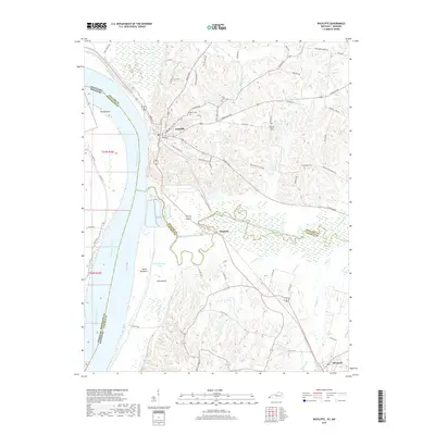
2019 Map of Wickliffe
USGS Topo · Published 2019About this map
Wickliffe stands at the confluence of the Mississippi River and the sweeping wetlands of the Jackson Purchase, where modern infrastructure meets a complex hydraulic landscape. The town sits on the eastern bluffs overlooking Island Number 1 and Cane Island, separated from the main river channel by the Island Number 1 Chute. South of town, the meandering Mayfield Creek feeds into Winford Pond, creating a labyrinth of sloughs such as Bab Slough and Minor Slough. This region's history is deeply connected to its river-borne economy and the shifting boundaries between Ballard and Carlisle counties. Genealogists will find several notable burial sites recorded, including the Wickliffe Cem and the Harrison Hughes Cem near Buckheart Cr. The map reveals a transition from the structured street grid of Bardwell in the southeast to the expansive agricultural bottomlands of Birds Point across the state line in Missouri.
Find a feature on this map
80 named features on this map. Tap any name to fly to it.
Don’t see what you’re looking for? This feature index may not catch every label — zoom into the map to look around manually.
Map Details
Editions of this 2019 Wickliffe Map
This is the sole edition of this map. No revisions or reprints were ever made.
Other maps of this area

1928 · La Center
USGS Topo · 1:62,500

1931 · Cairo
USGS Topo · 1:62,500

1932 · La Center
USGS Topo · 1:62,500

1933 · Cairo
USGS Topo · 1:62,500

1939 · Wickliffe
USGS Topo · 1:62,500

1939 · Cairo
USGS Topo · 1:62,500

1949 · Paducah
USGS Topo · 1:250,000

1950 · Paducah
USGS Topo · 1:250,000

1951 · Blandville
USGS Topo · 1:24,000

1951 · Wickliffe SW
USGS Topo · 1:24,000