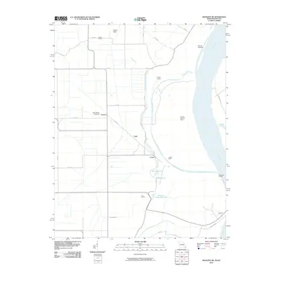
2010 Map of Wickliffe SW
USGS Topo · Published 2010About this map
Mississippi River dynamics dominate this portion of Mississippi County, where the massive waterway forms the border between Missouri and Kentucky. The landscape is defined by its relationship to the water, featuring the extensive New Madrid Floodway and a series of secondary channels like Number 3 Chute. Low-lying terrain is marked by distinctive oxbow remnants and depressions such as Nolen Blue Hole, Bratcher Lake, and Thirtyfour Corner Blue Hole. Small settlements like Deventer, Crosno, and Belmont are connected by a network of county roads and the primary Levee Rd. Family history is rooted in the high ground of O'Bryan Ridge, home to the O'Bryan Cemetery, while the river's edge maintains its historical utility through O'Bryan Landing and McFadden Landing.
Find a feature on this map
33 named features on this map. Tap any name to fly to it.
Don’t see what you’re looking for? This feature index may not catch every label — zoom into the map to look around manually.
Map Details
Editions of this 2010 Wickliffe SW Map
This is the sole edition of this map. No revisions or reprints were ever made.
Other maps of this area

1939 · Wickliffe
USGS Topo · 1:62,500

1939 · Charleston
USGS Topo · 1:62,500

1939 · Hickman
USGS Topo · 1:62,500

1939 · Bayouville
USGS Topo · 1:62,500

1951 · Oakton
USGS Topo · 1:24,000

1951 · Wolf Island
USGS Topo · 1:24,000

1951 · Wickliffe SW
USGS Topo · 1:24,000

1951 · Arlington
USGS Topo · 1:24,000

1951 · Wickliffe
USGS Topo · 1:24,000

1952 · Wickliffe
USGS Topo · 1:62,500