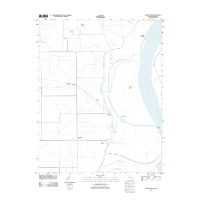
2012 Map of Wickliffe SW
USGS Topo · Published 2012About this map
The Mississippi River forms a dynamic boundary in this 2012 survey, revealing the alluvial landscape of Mississippi County where water and land are inextricably linked. The terrain is defined by riverine features like Number 3 Chute, Lucas Bend, and O'Bryan Towhead, highlighting the shifting path of the river over time. Inland, the grid of county roads connects rural settlements including Deventer, Fuget, Crosno, and Thirtyfour Corner.
Find a feature on this map
34 named features on this map. Tap any name to fly to it.
Don’t see what you’re looking for? This feature index may not catch every label — zoom into the map to look around manually.
Map Details
Editions of this 2012 Wickliffe SW Map
This is the sole edition of this map. No revisions or reprints were ever made.
Other maps of this area

1939 · Wickliffe
USGS Topo · 1:62,500

1939 · Charleston
USGS Topo · 1:62,500

1939 · Hickman
USGS Topo · 1:62,500

1939 · Bayouville
USGS Topo · 1:62,500

1951 · Oakton
USGS Topo · 1:24,000

1951 · Wolf Island
USGS Topo · 1:24,000

1951 · Wickliffe SW
USGS Topo · 1:24,000

1951 · Arlington
USGS Topo · 1:24,000

1951 · Wickliffe
USGS Topo · 1:24,000

1952 · Wickliffe
USGS Topo · 1:62,500