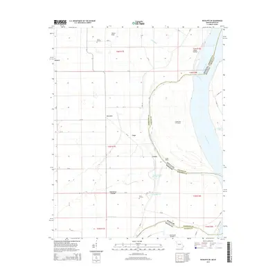
2015 Map of Wickliffe SW
USGS Topo · Published 2015About this map
The Mississippi River forms a complex border between Missouri and Kentucky on this sheet, defining a landscape of chutes, bends, and blue hole lakes. Along the western banks in Mississippi County, small rural settlements like Deventer, Fuget, and Crosno sit atop the fertile ground of O'Bryan Ridge. The presence of O'Bryan Cemetery and Travis Cemetery offers specific points of interest for genealogists tracing families in this flood-prone river bottom region.
Find a feature on this map
47 named features on this map. Tap any name to fly to it.
Don’t see what you’re looking for? This feature index may not catch every label — zoom into the map to look around manually.
Map Details
Editions of this 2015 Wickliffe SW Map
This is the sole edition of this map. No revisions or reprints were ever made.
Other maps of this area

1939 · Wickliffe
USGS Topo · 1:62,500

1939 · Charleston
USGS Topo · 1:62,500

1939 · Hickman
USGS Topo · 1:62,500

1939 · Bayouville
USGS Topo · 1:62,500

1951 · Oakton
USGS Topo · 1:24,000

1951 · Wolf Island
USGS Topo · 1:24,000

1951 · Wickliffe SW
USGS Topo · 1:24,000

1951 · Arlington
USGS Topo · 1:24,000

1951 · Wickliffe
USGS Topo · 1:24,000

1952 · Wickliffe
USGS Topo · 1:62,500