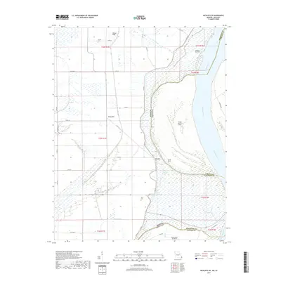
2017 Map of Wickliffe SW
USGS Topo · Published 2017About this map
O'Bryan Ridge and the surrounding alluvial plains of the Mississippi River define this corner of the Missouri Bootheel, captured here in the late 2010s. The landscape is a complex network of drainage ditches and levees, such as Lateral Number 3 and Levee Rd, protecting the agricultural interests around the small settlements of Deventer and Crosno. This area is characterized by remnant wetlands and backwaters, including Glory Bayou, Nolen Blue Hole, and Bratcher Lake, which mark the river's historical shifts and its current boundary between Missouri and Kentucky. Local genealogy is anchored by family-named landmarks like the O'Bryan Cem and Travis Cem. Along the river's edge, features such as O'Bryan Towhead and Islands Nos 2 3 and 4 illustrate the dynamic nature of the waterway, while Lucas Bend provides a major navigational landmark within this river-bound geography.
Find a feature on this map
46 named features on this map. Tap any name to fly to it.
Don’t see what you’re looking for? This feature index may not catch every label — zoom into the map to look around manually.
Map Details
Editions of this 2017 Wickliffe SW Map
This is the sole edition of this map. No revisions or reprints were ever made.
Other maps of this area

1939 · Wickliffe
USGS Topo · 1:62,500

1939 · Charleston
USGS Topo · 1:62,500

1939 · Hickman
USGS Topo · 1:62,500

1939 · Bayouville
USGS Topo · 1:62,500

1951 · Oakton
USGS Topo · 1:24,000

1951 · Wolf Island
USGS Topo · 1:24,000

1951 · Wickliffe SW
USGS Topo · 1:24,000

1951 · Arlington
USGS Topo · 1:24,000

1951 · Wickliffe
USGS Topo · 1:24,000

1952 · Wickliffe
USGS Topo · 1:62,500