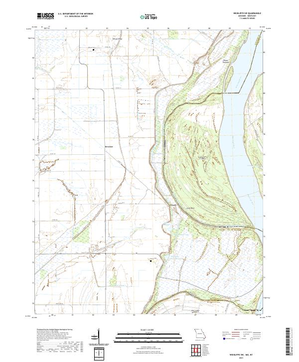
2021 Map of Wickliffe SW
USGS Topo · Published 2021About this map
Deventer and Crosno sit atop the low alluvial plains of the Mississippi River valley, where the borders of Missouri and Kentucky are defined by the ever-shifting main channel. The landscape is dominated by complex water systems, including Glory Bayou and numerous remnants of former river paths such as the Nolen Blue Hole and Thirtyfour Corner Blue Hole. These features, along with Number 3 Chute, reflect the hydrological character of the region before modern drainage and levee systems fully stabilized the floodplains. Extensive levee work is evidenced by the prominent Levee Rd running north-south through the center of the sheet.
Find a feature on this map
41 named features on this map. Tap any name to fly to it.
Don’t see what you’re looking for? This feature index may not catch every label — zoom into the map to look around manually.
Map Details
Editions of this 2021 Wickliffe SW Map
This is the sole edition of this map. No revisions or reprints were ever made.
Other maps of this area

1939 · Wickliffe
USGS Topo · 1:62,500

1939 · Charleston
USGS Topo · 1:62,500

1939 · Hickman
USGS Topo · 1:62,500

1939 · Bayouville
USGS Topo · 1:62,500

1951 · Oakton
USGS Topo · 1:24,000

1951 · Wolf Island
USGS Topo · 1:24,000

1951 · Wickliffe SW
USGS Topo · 1:24,000

1951 · Arlington
USGS Topo · 1:24,000

1951 · Wickliffe
USGS Topo · 1:24,000

1952 · Wickliffe
USGS Topo · 1:62,500