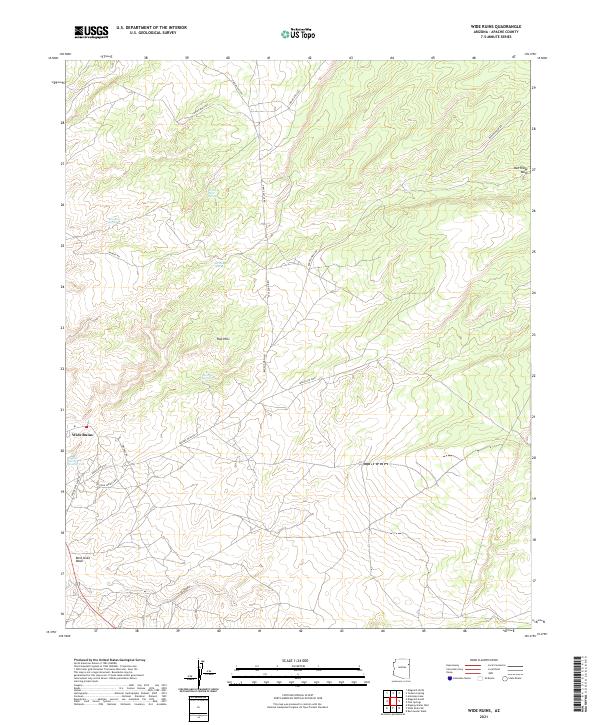
2021 Map of Wide Ruins
USGS Topo · Published 2021About this map
Wide Ruins anchors this high-desert landscape in Apache County, where the terrain is defined by a network of drainage washes and vital natural springs. The topography transitions from the distinct Red Hills in the center of the sheet toward the northern drainage of Oak Ridge Wash and the southern Bent Knee Wash. These watercourses dictate the historical movement through the area, reflected in the path of Banana Wash Rd and the Wide Ruins Loop.
Find a feature on this map
23 named features on this map. Tap any name to fly to it.
Don’t see what you’re looking for? This feature index may not catch every label — zoom into the map to look around manually.
Map Details
Editions of this 2021 Wide Ruins Map
This is the sole edition of this map. No revisions or reprints were ever made.
Other maps of this area

1886 · Fort Defiance
USGS Topo · 1:250,000

1892 · Fort Defiance
USGS Topo · 1:250,000

1954 · Gallup
USGS Topo · 1:250,000

1958 · Gallup
USGS Topo · 1:250,000

1959 · Gallup
USGS Topo · 1:250,000

1962 · Gallup
USGS Topo · 1:250,000

1967 · Gallup
USGS Topo · 1:250,000

1971 · Wide Ruins
USGS Topo · 1:24,000

1971 · Burntwater Wash
USGS Topo · 1:24,000
1971 · Tudecoz Spring
USGS Topo · 1:24,000