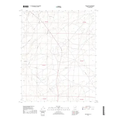
2018 Map of Wide Ruins SW
USGS Topo · Published 2018About this map
Padres Mesa dominates the western landscape of this Apache County region, where the terrain is marked by a series of high mesas and arid drainage patterns. A network of local infrastructure, primarily managed by the Indian Rte 9409 and other arterial routes, connects the remote reaches of the Navajo Nation territory. This 2018 survey documents a modern landscape still defined by its traditional land-use patterns, with prominent roadways like Burntwater Rd and La Pinta Mesa Rd tracing the natural contours of the high desert. The grid-like survey boundaries of several townships, including t22n r27e, provide the legal framework for this expansive area near the Fort Defiance Agency. For those researching local geography, the map reveals the specific alignment of secondary routes such as Blue Metal Rd as they navigate the mesas.
Find a feature on this map
15 named features on this map. Tap any name to fly to it.
Don’t see what you’re looking for? This feature index may not catch every label — zoom into the map to look around manually.
Map Details
Editions of this 2018 Wide Ruins SW Map
This is the sole edition of this map. No revisions or reprints were ever made.
Other maps of this area

1886 · Fort Defiance
USGS Topo · 1:250,000

1892 · Fort Defiance
USGS Topo · 1:250,000

1954 · Gallup
USGS Topo · 1:250,000

1958 · Gallup
USGS Topo · 1:250,000

1959 · Gallup
USGS Topo · 1:250,000

1962 · Gallup
USGS Topo · 1:250,000

1967 · Gallup
USGS Topo · 1:250,000

1971 · Wide Ruins
USGS Topo · 1:24,000

1971 · Burntwater Wash
USGS Topo · 1:24,000
1971 · Sanders
USGS Topo · 1:24,000