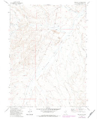
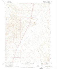
1971 Map of Wieland Flat
USGS Topo · Published 1983About this map
Wieland Flat and the surrounding drainage basins of Elko County define this high-desert landscape in the early 1970s. The map highlights a network of ephemeral and perennial water sources critical for ranching and mining, including China Spring and Dogies Well. Local industrial activity is concentrated in the northeast near Gance Creek, where a Coal Mine and the accompanying Coal Mine Road mark the exploitation of natural resources in the Great Basin.
Find a feature on this map
24 named features on this map. Tap any name to fly to it.
Don’t see what you’re looking for? This feature index may not catch every label — zoom into the map to look around manually.
Map Details
Editions of this 1971 Wieland Flat Map
2 editions found
Other maps of this area

1955 · Wells
USGS Topo · 1:250,000

1958 · Wells
USGS Topo · 1:250,000

1958 · Singletree Creek
USGS Topo · 1:24,000

1961 · Wells
USGS Topo · 1:250,000

1971 · Mahala Creek West
USGS Topo · 1:24,000
1971 · Coal Mine Basin
USGS Topo · 1:24,000
1971 · Dinner Station
USGS Topo · 1:24,000
1971 · The Buttes
USGS Topo · 1:24,000
1971 · Wieland Flat
USGS Topo · 1:24,000
1971 · Reed Station
USGS Topo · 1:24,000