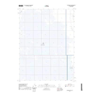
2023 Map of Wig Mountain NW
USGS Topo · Published 2023About this map
Great Salt Lake Desert dominates this landscape, showing the stark environment of the Tooele County basin in the early twenty-first century. The area is characterized by vast alkali flats and is largely defined by restricted military operations. Significant portions of the quadrangle fall within the Utah Test and Training Range and the West Desert Test Center, highlighting the region's role in aerospace and defense testing. Human infrastructure is nearly absent from the terrain, with only White Rock Rd cutting through the northwestern corner. The map documents the grid-system sections of this arid landscape where the natural environment and federal military installations intersect far from the state's population centers.
Find a feature on this map
4 named features on this map. Tap any name to fly to it.
Don’t see what you’re looking for? This feature index may not catch every label — zoom into the map to look around manually.
Map Details
Editions of this 2023 Wig Mountain NW Map
This is the sole edition of this map. No revisions or reprints were ever made.
Other maps of this area

1953 · Tooele
USGS Topo · 1:250,000

1954 · Wig Mtn SW
USGS Topo · 1:24,000

1954 · Wildcat Mtn
USGS Topo · 1:24,000

1954 · Wildcat Mtn SE
USGS Topo · 1:24,000

1954 · Wig Mtn NW
USGS Topo · 1:24,000

1955 · Wig Mtn
USGS Topo · 1:24,000

1955 · Wig Mtn NE
USGS Topo · 1:24,000

1955 · Tooele
USGS Topo · 1:250,000

1973 · Knolls SE
USGS Topo · 1:24,000

1973 · Aragonite SE
USGS Topo · 1:24,000