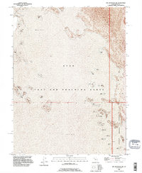
1993 Map of Wig Mtn NW
USGS Topo · Published 1996About this map
Mud Flat and shifting Sand Dunes dominate this desolate stretch of the Great Salt Lake Desert, where the landscape is defined by its use as a restricted military zone. The territory is split between the Utah Test and Training Range and the Dugway Proving Ground, illustrating the mid-century expansion of military aviation and weapons testing in the American West. While the topographical data reflects surveys dating back to the 1950s, this 1993 revision highlights the persistent isolation and specialized purpose of the Tooele County desert. Researchers of military history and cartographers will find value in the precise boundary markers for the proving grounds amidst the natural alkaline flats.
Find a feature on this map
6 named features on this map. Tap any name to fly to it.
Don’t see what you’re looking for? This feature index may not catch every label — zoom into the map to look around manually.
Map Details
Editions of this 1993 Wig Mtn NW Map
This is the sole edition of this map. No revisions or reprints were ever made.
Other maps of this area

1953 · Tooele
USGS Topo · 1:250,000

1954 · Wig Mtn SW
USGS Topo · 1:24,000

1954 · Wildcat Mtn
USGS Topo · 1:24,000

1954 · Wildcat Mtn SE
USGS Topo · 1:24,000

1954 · Wig Mtn NW
USGS Topo · 1:24,000

1955 · Wig Mtn
USGS Topo · 1:24,000

1955 · Wig Mtn NE
USGS Topo · 1:24,000

1955 · Tooele
USGS Topo · 1:250,000

1973 · Knolls SE
USGS Topo · 1:24,000

1973 · Aragonite SE
USGS Topo · 1:24,000